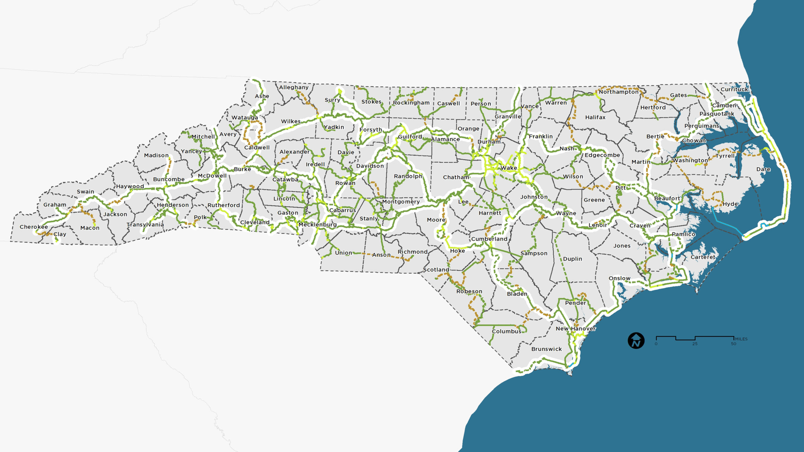
Stewart assisted North Carolina Department of Transportation (NCDOT) Integrated Mobility Division (IMD) along with Alta in developing the Great Trail State Plan. This plan draws upon existing plans and new recommendations to identify a network of shared-use paths that will connect every county in North Carolina. This system will support low-stress travel between county
seats and/or other urban/town centers, state parks, and other destinations. The planning process included an analysis of existing trails, plans, key destinations, bicycle level of service, and green infrastructure throughout the state. It also included facilitating meetings with a steering committee and gathering input from hundreds of stakeholders and thousands of North Carolina residents.
The primary outcomes of this planning process include an overall system map and division level maps that outline a statewide system of greenways that will eventually connect all 100 counties within North Carolina and implementation strategies. The final report succinctly summarizes goals, processes and methods for developing the Great Trail State Plan.
The scale of the planning effort was challenging but also exciting due to the goal of linking regional trail networks together to create a system that supports transportation, travel, recreation, and economic development.

